 vesseltracker.com
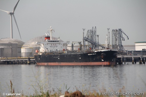
Vessel LUCIA SOLIS IMO: 9333187, MMSI: 525114060 Oil Products Tanker
UTC, 1.24957, 103.68858, course: 343, speed: 0
UTC, 1.24950, 103.68910, course: 343, speed: 0
2026-02-25 03:34:28 UTC, 1.24953, 103.68905, course: 343, speed: 0
Live AIS position:
UTC. Near JURONG ISLAND),
updated 2026-02-25 03:34:28 UTC.
Find the position of the vessel LUCIA SOLIS on the map. The latter are known coordinates and path.
marine traffic ship tracker show on live map
The current position of vessel LUCIA SOLIS is 1.24953 lat / 103.68905 lng. Updated: 2026-02-25 03:34:28 UTCCurrently sailing under the flag of Indonesia
LUCIA SOLIS built in 2007 year
Deadweight:
45980 tDetails:
Last coordinates of the vessel:
UTC, 1.24940, 103.68897, course: 343, speed: 0UTC, 1.24957, 103.68858, course: 343, speed: 0
UTC, 1.24950, 103.68910, course: 343, speed: 0
2026-02-25 03:34:28 UTC, 1.24953, 103.68905, course: 343, speed: 0